Mapbox地形切片及osgearth代码实现加载高程数据
本文参考:
osgearth加载mapbox在线高程数据
Mapbox Terrain-DEM地形切片原理浅析
本文分为三个部分:
1.mapbox部分地图数据简介
2.自建mapbox高程数据
3.使用osgearth加载mapbox高程数据
注:2.3. 部分都是别人博客内容,两个部分没有什么联系,但是使用步骤是前后关系。
一、MAPbox部分地图数据简介:
1.mapbox-terrain-dem-v1
官方介绍:
https://docs.mapbox.com/data/tilesets/reference/mapbox-terrain-dem-v1/
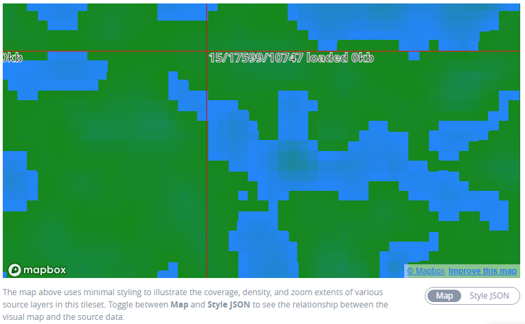
Mapbox Terrain-DEM v1 是 Mapbox 提供的光栅图块集,是一个全局海拔层。此图块集包含 PNG 图块的红色、绿色和蓝色通道中以米为单位的原始高度值,可以解码为以米为单位的原始高度。Mapbox Terrain-DEM 是 Mapbox Terrain-RGB v1 图块集的优化版本,具有一些更新的数据和一些压缩,以降低较低缩放级别的精度,从而制作更小、更快加载的图块。您可以将 Terrain-DEM 用于各种应用程序,包括视觉和分析,从样式地形斜坡和山影到为视频游戏生成 3D 地形网格。

2.mapbox-terrain-rgb-v1
官方介绍:
https://docs.mapbox.com/data/tilesets/reference/mapbox-terrain-rgb-v1/
Mapbox Terrain-RGB 是 Mapbox 提供的光栅瓦片集,包含以光栅 PNG 瓦片编码的全局高程数据,作为颜色值,可以解码为以米为单位的原始高度。您可以将 Terrain-RGB 用于各种视觉和分析应用,从设计地形斜坡和山影到为视频游戏生成 3D 地形网格。

================================================================
二、MAPbox数据切片及原理
1.Mapbox地形切片简介
那么如有生成离线地形需求时,就可以通过在NASA上按经纬度下载相应范围的geotiff格式的dem数据,然后将tif-dem(高程灰度图)转化/编码为tif-RGB格式,然后使用相应的切片工具进行切片(按照相应mapbox相应的规范组织瓦片),而这些处理在github上已经有许多开源的处理工具,这里推荐一个集成了上面所有处理的工具(根据dem数据生成地形切片的工具),感兴趣的化也可以基于GDAL写一个。
对于Terrain-RGB的数据解码:Terrain-RGB 中每个颜色通道为 base-256,而三个颜色通道组成的为16,777,216 个值,这些值可以映射到 0.1 米的高度增量,从而实现三维地形应用所需的垂直精度,因此原来表示高程值是足够的。 mapbox收到图块后, 将需要获取各个像素的红色(R),绿色(G)和蓝色(B)值,然后根据下列公式解码为相应的高度值。
height = -10000 + ((R * 256 * 256 + G * 256 + B) * 0.1)
2.Terrain-RGB与Terrain-DEM
3.切片工具:
根据 DEM 数据生成地形切片工具,使用 NodeJS + GDAL(NodeBinding)开发制作。可用于用户自定义 DEM 高程数据源生产地形瓦片,以便局域网离线使用。
特点:
- 支持
mapbox和terrarium两种地形瓦片编码格式供mapboxgl使用,其中terrarium格式是tangram引擎的官方地形格式,tangram是另外一款开源的webgl二三维一体化的引擎; - 固定瓦片尺寸256,瓦片周围有1cell的buffer,即实际瓦片是258*258.
- 自动读取数据源的坐标系统,重编码输入的 DEM 栅格文件,并重投影至指定的坐标系4490、4326、3857,默认3857,然后生成瓦片;
- 支持适用于3857、4490、4326的地形切片生产;
- 内置了影像金字塔索引和多进程实现(暂未使用多线程),加速瓦片生成速度;
- 支持地形瓦片以文件目录或mbtiles两种格式存储;
- 命令行提供了瓦片生成的进图条提示,便于用户查看生成进度。
- 内置一些异常导致的临时文件清理工作。
三、OSGEARTH加载mapbox在线高程数据
mapbox的高程数据数据是rgba四通道的png格式栅格图像数据,而一般的高程数据HeightField是单通道的。
因此,在请求到源数据之后只需要做一次osg::Image -> osg::HeightField 的转换即可。
官网提供的转换公式:
height = -10000 + ((R * 256 * 256 + G * 256 + B) * 0.1)
通过继承 TileSource 重写 createImage 和 createHeightField 即可实现功能。
头文件
#include <osgEarth/Common>
#include <osgEarth/TileSource>
#include <osgEarth/URI>

using namespace osgEarth;

class CgMapboxTerrainOptions : public TileSourceOptions
{
public:
    optional<URI>& url() { return _url; }
    const optional<URI>& url() const { return _url; }

    optional<bool>& invertY() { return _invertY; }
    const optional<bool>& invertY() const { return _invertY; }

    optional<std::string>& format() { return _format; }
    const optional<std::string>& format() const { return _format; }

public:
    CgMapboxTerrainOptions(const TileSourceOptions& opt = TileSourceOptions()) : TileSourceOptions(opt)
    {
        setDriver("mapboxTer");
        fromConfig(_conf);
    }

    CgMapboxTerrainOptions(const std::string& inUrl) : TileSourceOptions()
    {
        setDriver("mapboxTer");
        fromConfig(_conf);
        url() = inUrl;
    }

    virtual ~CgMapboxTerrainOptions() { }

public:
    Config getConfig() const {
        Config conf = TileSourceOptions::getConfig();
        conf.updateIfSet("url", _url);
        conf.updateIfSet("format", _format);
        conf.updateIfSet("invert_y", _invertY);
        return conf;
    }

protected:
    void mergeConfig(const Config& conf) {
        TileSourceOptions::mergeConfig(conf);
        fromConfig(conf);
    }

private:
    void fromConfig(const Config& conf) {
        conf.getIfSet("url", _url);
        conf.getIfSet("format", _format);
        conf.getIfSet("invert_y", _invertY);
    }

    optional<URI>         _url;
    optional<std::string> _format;
    optional<bool>        _invertY;
};
TileSource 的实现
通过继承 TileSource 重写 createImage 和 createHeightField,并自定义 TileSourceDriver 使用新的TileSource。
#include "CgMapboxTerrainOptions.h"

#include <osgEarth/ImageUtils>
#include <osgDB/FileNameUtils>
#include <osgDB/FileUtils>
#include <osgDB/Registry>
#include <osgDB/ReadFile>
#include <osgEarth/Registry>

class MapBoxTerrainSource : public TileSource
{
public:
    MapBoxTerrainSource(const TileSourceOptions& options)
        :TileSource(options), _options(options), _rotate_iter(0u)
    {

    }

    Status initialize(const osgDB::Options* dbOptions)
    {
        _dbOptions = Registry::instance()->cloneOrCreateOptions(dbOptions);

        URI xyzURI = _options.url().value();
        if (xyzURI.empty())
        {
            return Status::Error("Fail: driver requires a valid \"url\" property");
        }

        // driver requires a profile.
        if (!getProfile())
        {
            return Status::Error("An explicit profile definition is required by the XYZ driver.");
        }

        _template = xyzURI.full();

        _rotateStart = _template.find("[");
        _rotateEnd = _template.find("]");
        if (_rotateStart != std::string::npos && _rotateEnd != std::string::npos && _rotateEnd - _rotateStart > 1)
        {
            _rotateString = _template.substr(_rotateStart, _rotateEnd - _rotateStart + 1);
            _rotateChoices = _template.substr(_rotateStart + 1, _rotateEnd - _rotateStart - 1);
        }

        _format = _options.format().isSet()
            ? *_options.format()
            : osgDB::getLowerCaseFileExtension(xyzURI.base());

        return STATUS_OK;
    }

    osg::Image* createImage(const TileKey& key, ProgressCallback*  progress)
    {
        unsigned x, y;
        key.getTileXY(x, y);

        if (_options.invertY() == true)
        {
            unsigned cols = 0, rows = 0;
            key.getProfile()->getNumTiles(key.getLevelOfDetail(), cols, rows);
            y = rows - y - 1;
        }

        std::string location = _template;

        // support OpenLayers template style:
        replaceIn(location, "${x}", Stringify() << x);
        replaceIn(location, "${y}", Stringify() << y);
        replaceIn(location, "${z}", Stringify() << key.getLevelOfDetail());

        // failing that, legacy osgearth style:
        replaceIn(location, "{x}", Stringify() << x);
        replaceIn(location, "{y}", Stringify() << y);
        replaceIn(location, "{z}", Stringify() << key.getLevelOfDetail());

        std::string cacheKey;

        if (!_rotateChoices.empty())
        {
            cacheKey = location;
            unsigned index = (++_rotate_iter) % _rotateChoices.size();
            replaceIn(location, _rotateString, Stringify() << _rotateChoices[index]);
        }


        URI uri(location, _options.url()->context());
        if (!cacheKey.empty())
            uri.setCacheKey(cacheKey);

        return uri.getImage(_dbOptions.get(), progress);
    }

    virtual std::string getExtension() const
    {
        return _format;
    }

    osg::HeightField* createHeightField(const TileKey& key, ProgressCallback* progress);

private:
    const CgMapboxTerrainOptions _options;
    std::string            _format;
    std::string            _template;
    std::string            _rotateChoices;
    std::string            _rotateString;
    std::string::size_type _rotateStart, _rotateEnd;
    OpenThreads::Atomic    _rotate_iter;

    osg::ref_ptr<osgDB::Options> _dbOptions;
};

osg::HeightField* MapBoxTerrainSource::createHeightField(const TileKey& key, ProgressCallback* progress)
{
    // height = -10000 + ((R * 256 * 256 + G * 256 + B) * 0.1)

    // MapBox encoded elevation PNG.
        // https://www.mapbox.com/blog/terrain-rgb/
    if (1/*_options.elevationEncoding().value() == "mapbox"*/)
    {
        if (getStatus().isError())
            return 0L;

        osg::HeightField *hf = 0;
        osg::ref_ptr<osg::Image> image = createImage(key, progress);
        if (image.valid())
        {
            // Allocate the heightfield.
            hf = new osg::HeightField();
            hf->allocate(image->s(), image->t());

            ImageUtils::PixelReader reader(image.get());
            for (unsigned int c = 0; c < image->s(); c++)
            {
                for (unsigned int r = 0; r < image->t(); r++)
                {
                    osg::Vec4 pixel = reader(c, r);
                    pixel.r() *= 255.0;
                    pixel.g() *= 255.0;
                    pixel.b() *= 255.0;
                    float h = -10000.0f + ((pixel.r() * 65536.0f + pixel.g() * 256.0f + pixel.b()) * 0.1f);
                    hf->setHeight(c, r, h);
                }
            }
        }
        return hf;
    }
    else
    {
        return TileSource::createHeightField(key, progress);
    }
}

class MapBoxTerrainTileSourceDriver : public TileSourceDriver
{
public:
    MapBoxTerrainTileSourceDriver()
    {
        supportsExtension("osgearth_mapboxTer", "mapboxTer Driver");
    }

    virtual const char* className()
    {
        return "mapboxTer Driver";
    }

    virtual ReadResult readObject(const std::string& file_name, const Options* options) const
    {
        if (!acceptsExtension(osgDB::getLowerCaseFileExtension(file_name)))
        {
            return ReadResult::FILE_NOT_HANDLED;
        }

        return new MapBoxTerrainSource(getTileSourceOptions(options));
    }
};

REGISTER_OSGPLUGIN(osgearth_mapboxTer, MapBoxTerrainTileSourceDriver)
调用
    CgMapboxTerrainOptions mbTerOpt;
    mbTerOpt.url() = "http://api.mapbox.com/v4/mapbox.terrain-rgb/{z}/{x}/{y}.pngraw?access_token=...";
    mbTerOpt.profile()->namedProfile() = "spherical-mercator";
    ElevationLayerOptions eoptions("mapboxEle", mbTerOpt);
    osg::ref_ptr<osgEarth::ElevationLayer> rpEleLayer = new osgEarth::ElevationLayer(eoptions);

    osg::ref_ptr<osgEarth::Map> rpMap = new osgEarth::Map(mapOpts);
    rpMap->addImageLayer(rpImagLayer.get());
    rpMap->addElevationLayer(rpEleLayer.get());
重新定义配置选项 CgMapboxTerrainOptions 和 TileSourceDriver 后,可以将mapbox在线高程数据加载出来。
参考文章:
osgearth加载mapbox在线高程数据